
 PL
PL
“Safe Vistula – towards a sustainable future” is a program of retention activities constituting an element of flood risk management in the water region of the Upper Western Vistula and the Upper Eastern Vistula between Krakow and Zawichost. Experts, in consultation with the State Water Holding Polish Waters and the inhabitants of the threatened areas, will work out the best flood protection methods.
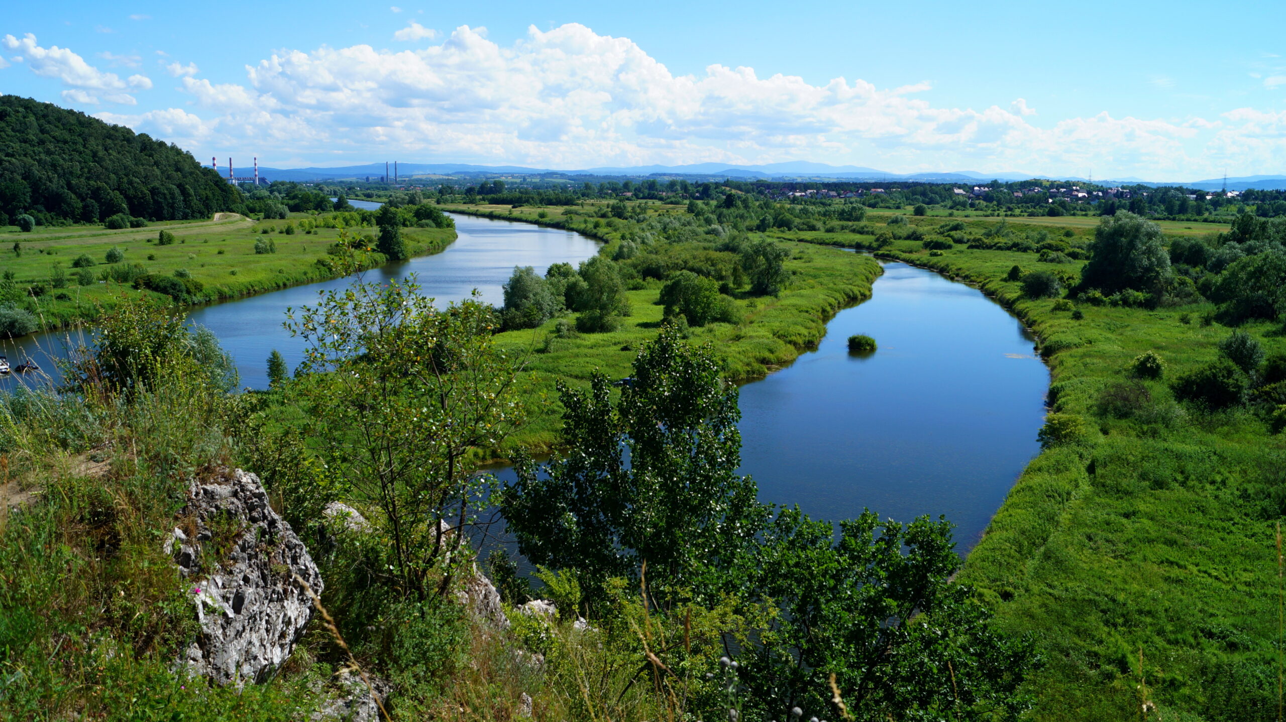
Climate warming has not removed the threat of flooding. This dangerous phenomenon has only changed its characteristics. Floods are no longer mainly caused by spring thaws and autumn downpours, as they used to be. The threat is now caused by torrential rains, also occurring in the middle of summer. It is particularly dangerous in mountain and foothill areas. The average annual damage caused by floods in the Upper Vistula basin is the highest in the country. Even a few hours of rapid precipitation is enough to turn a small stream or brook into a raging river, engulfing everything it encounters on its way and posing a threat not only to property, but also to people’s lives. These huge masses of water then flood the lower areas around the rivers, several dozen or even several hundred kilometers away. In 2010, such a situation was faced by e.g. inhabitants of the vicinity of Sandomierz and towns further along the Vistula River. The great water, the largest in 160 years, even reached Warsaw at that time.
Program objectives
The main objective of the “Safe Vistula – towards a sustainable future” program is to increase flood protection within the so-called Vistula Sandomierska, from the mouth of the Nida River to the mouth of the San River. However, a much larger area of the Vistula catchment area will be analyzed in search of additional possible measures that will reduce the risk of flooding on the Queen of Polish Rivers and her key tributaries. In the process of preparation and implementation of the Program, a team of experts, with the participation of representatives of local governments and local communities, will be formed to develop optimal solutions to reduce the flow of flood water and lower the height of the flood wave. The proposed set of technical and non-technical measures will take into account environmental and social issues.
The aim of the works supervised by the State Water Holding Polish Waters, RZGW Krakow is to minimize the flood risk for floods with the probability of occurring once in 100 years (1%-water).
The effect of the work of the Project will be:
1) Selection of optimal flood protection solutions based on cooperation, public consultations, and the involvement of key stakeholders
2) Identification and preliminary analysis of potential threats and benefits resulting from the proposed solutions in the field of flood protection, based on Strategic Environmental and Social Assessment (SESA)
Cooperation, consultations and joint solutions
The selection of optimal solutions to protect the Program area against flooding will take place in cooperation with representatives of local government units and local communities. An important stage of the work will be field visits to discuss problems and possible solutions in the field of flood protection. Social consultations and three expert conferences with the participation of representatives of local government units from the area covered by the Program are also planned. During the Project, communication activities will be carried out informing about the various stages of the project and the solutions developed.
Flood and drought protection
As part of the works, the existing studies, analyzes and programs will be verified in order to create a new program of retention activities together with a strategic environmental impact assessment for a part of the Upper Vistula river basin. The available hydraulic models developed within the Flood Hazard Maps project will be reviewed and new models for selected watercourses will be prepared. An analysis of the technical condition of infrastructure and spatial development will be carried out, with particular emphasis on identifying socially and environmentally important places (e.g. protected areas, cultural heritage sites, or areas earmarked for land acquisition) and sections of watercourses sensitive to erosion and sediment deposition. An important source of data, apart from hazard analyses and local investment programs, will be the causes, course, and effects of the 2010 flood. What is important, apart from the leading flood protection objective, the need to search for additional retention will also play a very important role in the analysis in the face of the drought problem emerging in this area.
“Safe Vistula – towards a sustainable future” appears under its full name as “Retention activities program as an element of flood risk management in the Upper Western Vistula and Upper Eastern Vistula water region between Krakow and Zawichost.” Apart from the provisions of the flood risk management plans, the legitimacy of the implementation of the “Safe Vistula” Program results from, among others, the findings of the Team for flood safety improvement in the area of the Vistula river basin in the Sandomierz region (Vistula Sandomierska). It was appointed during the works on the review and the update of flood risk management plans under the order of the President of State Water Holding Polish Waters on July 1, 2021. The Team consisted of representatives of local government units from the area of Vistula Sandomierska and State Water Holding Polish Waters.
The activities undertaken under the Program are accompanied by care to take into account the World Bank standards for Strategic Environmental and Social Assessment (SESA) studies. Contractors are also guided by the provisions of Directive 2007/60/WE of the European Parliament and of the Council of October 23, 2007 on the assessment and management of flood risks (the so-called Floods Directive), transferred to Polish legislation through the Water Law Act. The Program is implemented while maintaining substantive consistency with many planning documents in the area of water management in Poland. With documents such as:
1) Review and update of flood hazard maps and flood risk maps
2) Development of flood hazard maps and flood risk maps (riverine) regarding the results of the review and the update of the preliminary flood risk assessment (in preparation)
3) Review and update of flood risk management plans
4) The second update of the Water Management Plans (II aPGW)
5) A plan to counteract the effects of drought
6) Development of the Water Scarcity Prevention Program for 2021-2027 with an outlook until 2030
7) Implementation of instruments supporting the completion of Flood Risk Management Plans
8) Development of a national surface water renaturalization program
9) Contract 5.7.1 Program of non-technical and retention measures as an element of flood risk management in the water regions of the Little Vistula and the Upper Vistula (catchment area upstream of Krakow), taking into account flood protection of Krakow
10) Contract 4.B Operational Centers – task 4.B.1/1 Modernization and implementation of IT systems supporting the operational work of the Operational Centers in Krakow and Wroclaw, together with supplies of necessary hardware and software
Implementation and completion of the program will significantly increase the flood safety of the inhabitants of this area, as well as the areas located below the water region of the Upper Vistula, i.e. of the Central Vistula on the section all the way to Warsaw.
Financing of the Program
The Program is part of the OVFMP Project (Odra-Vistula Flood Management Project), financed by the World Bank.